Open Data
Amazon Location Service provides access to open source map data via the Open Data provider.
Open Data provides global basemaps built from the Daylight map distribution of OpenStreetMap (OSM), Natural
Earth, and other open data sources. The maps provided are designed to support
different applications and use cases, including logistics and delivery, and data
visualization in web and mobile environments. With over a million map makers, the OSM
community updates hundreds of thousands of features per day. Amazon Location Service regularly incorporates
these edits.
For additional capability information, see Open Data on
Amazon Location Service data providers.
Open Data map styles
Amazon Location Service supports the following map styles when creating a map
resource:
Open Data map styles support alternate Political views.
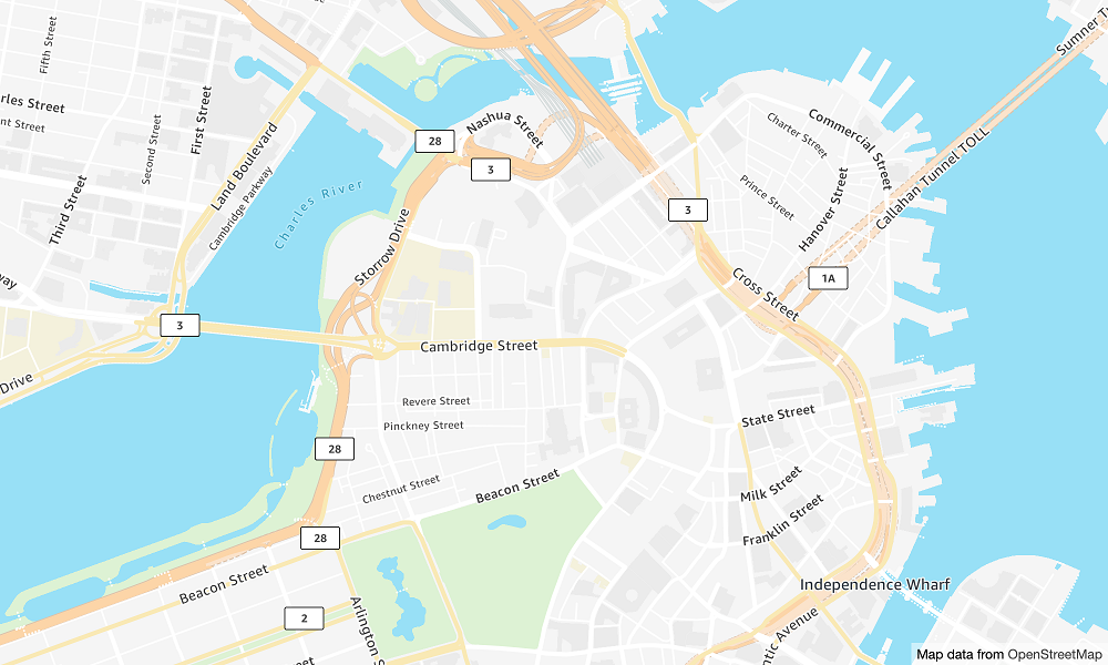
- Open Data Standard Light
-
Open Data Standard Light
Map style name:
VectorOpenDataStandardLight
This provides a detailed basemap for the world in a light map style,
suitable for website and mobile application use. This includes highways,
major roads, minor roads, railways, water features, cities, parks,
landmarks, building footprints, and administrative boundaries.
This basemap is based on the OSM Daylight map distribution compiled from OpenStreetMap (OSM)
contributors. The OSM community includes over 1.8 million contributors who
update more than 500,000 features daily. Amazon Location Service incorporates these edits
on a regular basis.
Fonts
Amazon Location serves fonts using GetMapGlyphs. The following are available font
stacks for this map:
-
Amazon Ember Bold,Noto Sans Bold
-
Amazon Ember Condensed RC Bold,Noto Sans Bold
-
Amazon Ember Condensed RC Regular,Noto Sans Regular
-
Amazon Ember Medium,Noto Sans Medium
-
Amazon Ember Regular Italic,Noto Sans Italic
-
Amazon Ember Regular,Noto Sans Regular
-
Amazon Ember Regular,Noto Sans Regular,Noto Sans Arabic Regular
-
Amazon Ember Condensed RC Bold,Noto Sans Bold,Noto Sans Arabic
Condensed Bold
-
Amazon Ember Bold,Noto Sans Bold,Noto Sans Arabic Bold
-
Amazon Ember Regular Italic,Noto Sans Italic,Noto Sans Arabic
Regular
-
Amazon Ember Condensed RC Regular,Noto Sans Regular,Noto Sans Arabic
Condensed Regular
-
Amazon Ember Medium,Noto Sans Medium,Noto Sans Arabic Medium
The fonts used by VectorOpenDataStandardLight are
combined fonts that use Amazon Ember for most glyphs
but Noto Sans for glyphs unsupported by
Amazon Ember.
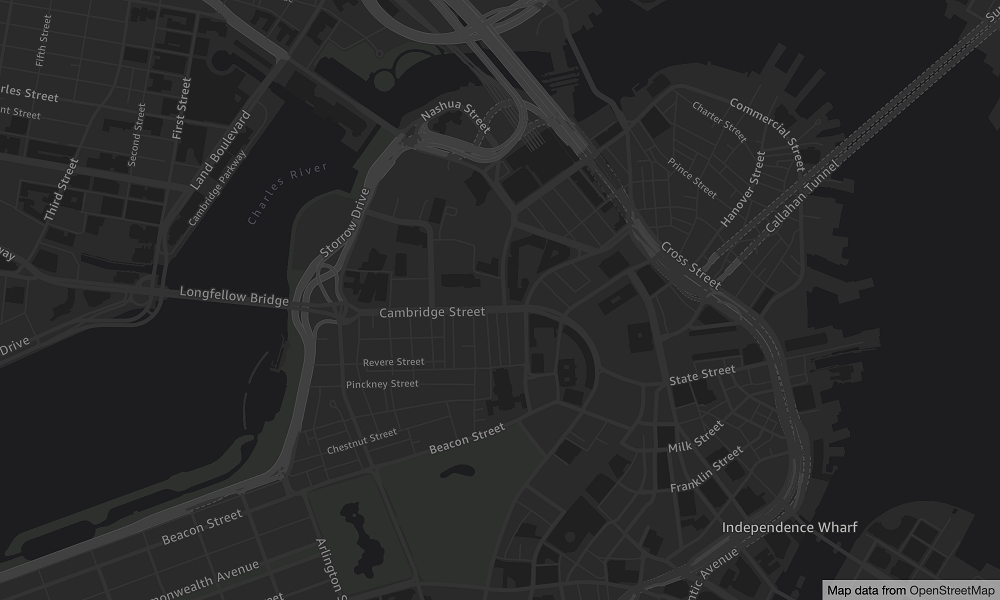
- Open Data Standard Dark
-
Open Data Standard Dark
Map style name:
VectorOpenDataStandardDark
This is a dark-themed map style that provides a detailed basemap for the
world, suitable for website and mobile application use. This includes
highways, major roads, minor roads, railways, water features, cities, parks,
landmarks, building footprints, and administrative boundaries.
This basemap is based on the OSM Daylight map distribution compiled from OpenStreetMap (OSM)
contributors. The OSM community includes over 1.8 million contributors who
update more than 500,000 features daily. Amazon Location Service incorporates these edits
on a regular basis.
Fonts
Amazon Location serves fonts using GetMapGlyphs. The following are available font
stacks for this map:
-
Amazon Ember Bold,Noto Sans Bold
-
Amazon Ember Condensed RC Bold,Noto Sans Bold
-
Amazon Ember Condensed RC Regular,Noto Sans Regular
-
Amazon Ember Medium,Noto Sans Medium
-
Amazon Ember Regular Italic,Noto Sans Italic
-
Amazon Ember Regular,Noto Sans Regular
-
Amazon Ember Regular,Noto Sans Regular,Noto Sans Arabic Regular
-
Amazon Ember Condensed RC Bold,Noto Sans Bold,Noto Sans Arabic
Condensed Bold
-
Amazon Ember Bold,Noto Sans Bold,Noto Sans Arabic Bold
-
Amazon Ember Regular Italic,Noto Sans Italic,Noto Sans Arabic
Regular
-
Amazon Ember Condensed RC Regular,Noto Sans Regular,Noto Sans Arabic
Condensed Regular
-
Amazon Ember Medium,Noto Sans Medium,Noto Sans Arabic Medium
The fonts used by VectorOpenDataStandardDark are
combined fonts that use Amazon Ember for most glyphs
but Noto Sans for glyphs unsupported by
Amazon Ember.
- Open Data Visualization Light
-
Open Data Visualization Light
Map style name:
VectorOpenDataVisualizationLight
This is a light-themed style with muted colors and fewer features that
aids in understanding overlaid data.
This basemap is based on the OSM Daylight map distribution compiled from OpenStreetMap (OSM)
contributors. The OSM community includes over 1.8 million contributors who
update more than 500,000 features daily. Amazon Location Service incorporates these edits
on a regular basis.
Fonts
Amazon Location serves fonts using GetMapGlyphs. The following are available font
stacks for this map:
-
Amazon Ember Bold,Noto Sans Bold
-
Amazon Ember Condensed RC Bold,Noto Sans Bold
-
Amazon Ember Condensed RC Regular,Noto Sans Regular
-
Amazon Ember Medium,Noto Sans Medium
-
Amazon Ember Regular Italic,Noto Sans Italic
-
Amazon Ember Regular,Noto Sans Regular
-
Amazon Ember Regular,Noto Sans Regular,Noto Sans Arabic Regular
-
Amazon Ember Condensed RC Bold,Noto Sans Bold,Noto Sans Arabic
Condensed Bold
-
Amazon Ember Bold,Noto Sans Bold,Noto Sans Arabic Bold
-
Amazon Ember Regular Italic,Noto Sans Italic,Noto Sans Arabic
Regular
-
Amazon Ember Condensed RC Regular,Noto Sans Regular,Noto Sans Arabic
Condensed Regular
-
Amazon Ember Medium,Noto Sans Medium,Noto Sans Arabic Medium
The fonts used by VectorOpenDataVisualizationLight are
combined fonts that use Amazon Ember for most glyphs
but Noto Sans for glyphs unsupported by
Amazon Ember.
- Open Data Visualization Dark
-
Open Data Visualization Dark
Map style name:
VectorOpenDataVisualizationDark
This is a dark-themed style with muted colors and fewer features that aids
in understanding overlaid data.
This basemap is based on the OSM Daylight map distribution compiled from OpenStreetMap (OSM)
contributors. The OSM community includes over 1.8 million contributors who
update more than 500,000 features daily. Amazon Location Service incorporates these edits
on a regular basis.
Fonts
Amazon Location serves fonts using GetMapGlyphs. The following are available font
stacks for this map:
-
Amazon Ember Bold,Noto Sans Bold
-
Amazon Ember Condensed RC Bold,Noto Sans Bold
-
Amazon Ember Condensed RC Regular,Noto Sans Regular
-
Amazon Ember Medium,Noto Sans Medium
-
Amazon Ember Regular Italic,Noto Sans Italic
-
Amazon Ember Regular,Noto Sans Regular
-
Amazon Ember Regular,Noto Sans Regular,Noto Sans Arabic Regular
-
Amazon Ember Condensed RC Bold,Noto Sans Bold,Noto Sans Arabic
Condensed Bold
-
Amazon Ember Bold,Noto Sans Bold,Noto Sans Arabic Bold
-
Amazon Ember Regular Italic,Noto Sans Italic,Noto Sans Arabic
Regular
-
Amazon Ember Condensed RC Regular,Noto Sans Regular,Noto Sans Arabic
Condensed Regular
-
Amazon Ember Medium,Noto Sans Medium,Noto Sans Arabic Medium
The fonts used by VectorOpenDataVisualizationDark are
combined fonts that use Amazon Ember for most glyphs
but Noto Sans for glyphs unsupported by
Amazon Ember.
Coverage: Open Data
Open Data includes maps with global coverage for rendering
with an Amazon Location Service map resource.
Open Data is for use with Amazon Location Service map resources only. You can't use Open Data
as a data provider to support queries for geocoding, reverse geocoding, and
searches, or to support queries to calculate a route.
Terms of use and data attribution: Open Data
Before you use Open Data, be sure you can comply with all applicable legal
requirements, including license terms applicable to Open Data and AWS.
For more information about the AWS requirements, see AWS Service Terms.
For information about Open Data attribution guidelines, see OpenStreetMap's Copyright and License and
OpenStreetMap's Licence/Attribution Guidelines.
Error reporting and contributing to Open Data
OpenStreetMap (OSM) and Natural Earth are community-driven open data projects. If you
encounter a problem with the data, you can report the errors or directly contribute
fixes or suggestions.
-
To report an error or offer a suggestion in OSM, you can create a
note on the map. This is a comment on the map that
assists contributors in making fixes to the map. You create notes through the
OpenStreetMap website. For
more information about notes, see Notes in the
OpenStreetMap wiki.
-
For more information about contributing directly to OpenStreetMap, including
adding locations and fixing errors, see Contribute map
data in the OpenStreetMap wiki.
-
To submit a correction request for data in Natural Earth, you can submit
an issue through the Natural
Earth website.
Correcting errors in OpenStreetMap can happen quickly, however, it can take
time for corrections to appear in the Daylight map distribution of the OSM data
that is used by the Open Data provider. The Daylight Map Distribution website provides more information about
the process. Additionally, Amazon Location Service updates the map data used in
Amazon Location Service approximately monthly.