Select your cookie preferences

We use essential cookies and similar tools that are necessary to provide our site and services. We use performance cookies to collect anonymous statistics, so we can understand how customers use our site and make improvements. Essential cookies cannot be deactivated, but you can choose “Customize” or “Decline” to decline performance cookies.

If you agree, AWS and approved third parties will also use cookies to provide useful site features, remember your preferences, and display relevant content, including relevant advertising. To accept or decline all non-essential cookies, choose “Accept” or “Decline.” To make more detailed choices, choose “Customize.”

Monochrome map style

Focus mode
Monochrome map style - Amazon Location Service

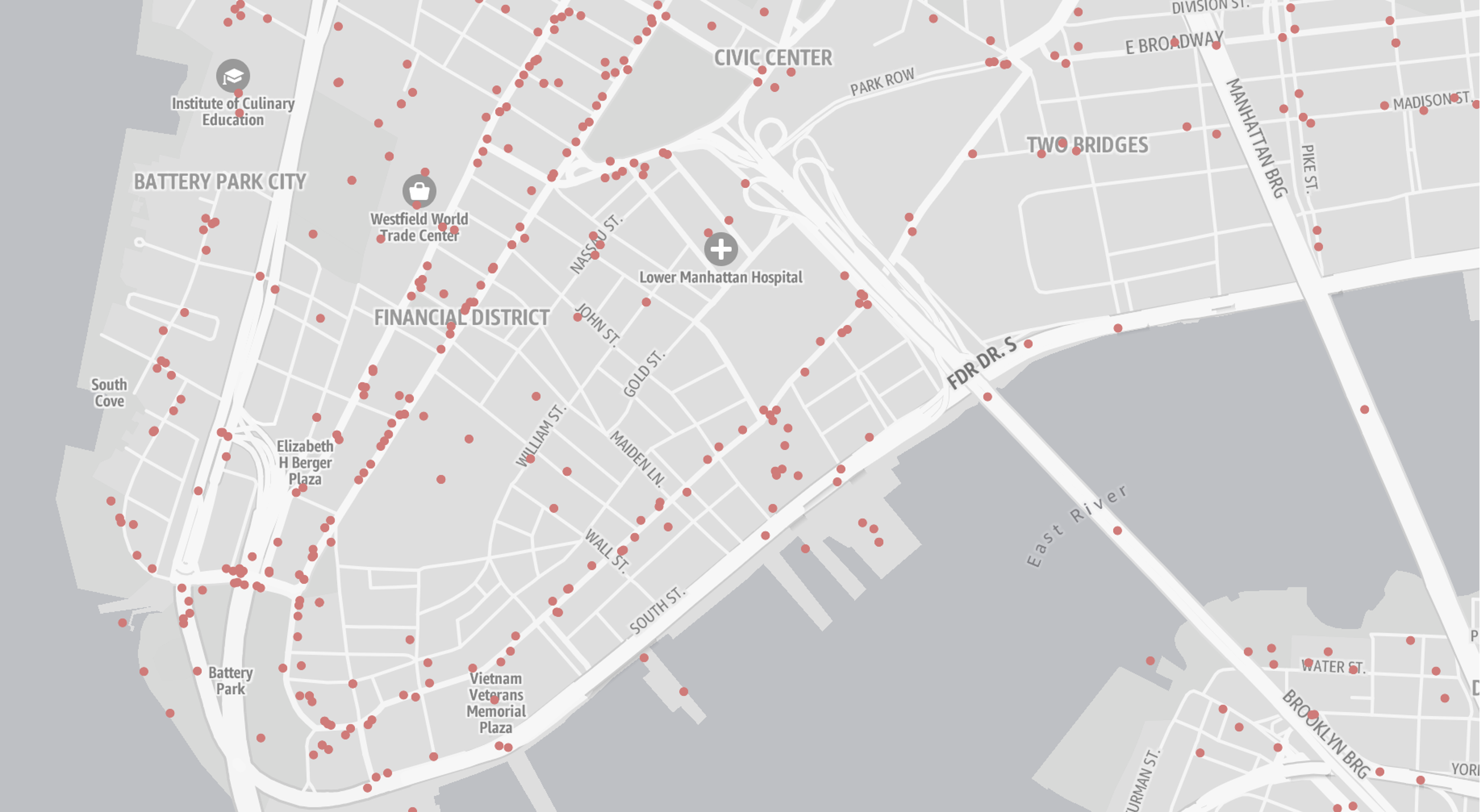
The Monochrome style is a minimalist canvas with a constrained color palette, designed for use with data visualization overlays. This style supports both light and dark modes, each of which communicates all the essential information needed for geographic context.

Color schemes

The Monochrome style offers color choices for both dark and light modes.

Continent
Map of North America showing the United States, Canada, Mexico, and parts of Central and South America.
Neighborhood
Map of Downtown Miami showing streets, parks, and landmarks in light and dark modes.
Map of North America showing the United States, Canada, Mexico, and parts of Central and South America.

Use cases

The Monochrome style is well-suited for data visualization and minimalistic design needs.

Data visualization

The Monochrome style deliberately uses only shades of gray, allowing you complete freedom of color choice for data overlay layers such as choropleths, heatmaps, or dot maps.

Map of lower Manhattan showing streets, landmarks, and red dots indicating data points.

Minimalist design

To maintain a clean and unobtrusive map, the Monochrome styles include a reduced set of points of interest (POIs) for essential features, such as airports, parks, hospitals, and universities.

Airport
Map showing Miami International Airport and surrounding roads including Airport Expy and Dolphin Expy.
Neighborhood
Map showing Jackson Memorial Hospital, UHealth Tower, and nearby streets in light and dark modes.
Map showing Miami International Airport and surrounding roads including Airport Expy and Dolphin Expy.

Although the Monochrome style includes a reduced set of POIs, the underlying tiles still contain the complete set of POI data. This allows you to display POIs that are not visually present in the style.

Designed for the world

The Monochrome style supports different political views, ensuring that maps display the correct borders for your users. The style also allows for easy switching between languages for map labels, with dozens of supported languages and writing systems.

Map of Taiwan showing major cities and the Taiwan Strait, with a monochrome color scheme.

On this page

PrivacySite termsCookie preferences
© 2025, Amazon Web Services, Inc. or its affiliates. All rights reserved.